
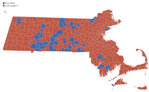
WBUR has a fun interactive map of how Massachusetts towns have voted for governor since 1970. The screen shot above is from 1970’s race between incumbent Frank Sargent and Boston Mayor Kevin White, who couldn’t even win his own home city. But Sargent, a Republican, got swamped by Michael Dukakis, a Democrat, in the first post-Watergate election in 1974 (see map at ‘BUR). … Other interesting tidbits from the maps: Bill Weld’s blowout re-election win in 1994 (forgot how big it was) and Shannon O’Brien’s surprisingly strong western Mass. showing despite her loss to Mitt Romney in 2002. … Lots of other old names pop up over the years. Check it out. …
Thinking it over, I’d love to see similar partisan timeline maps for Mass. Congressional races since 1950. Ditto legislative races (if it’s possible). Even though district maps change every ten years, they’d undoubtably show the sharp Camelot/Watergate-induced declines of the Republican Party in Massachusetts. … Of course, the Congressional maps would get boringly all blue after 1994, the last time a Republican won a U.S. House seat in Mass.

